
La Selva has more than 350 km of paths that allow you to travel through the region along the coast, the plains and the mountains. This network makes it easy to design your own itineraries and discover the territory on your own.
The network includes forest trails, greenways and little-traveled roads, with routes of varying difficulty levels. The climate, favorable for much of the year, makes it easy to practice.
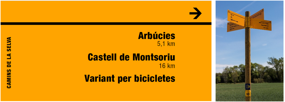
Network Signaling
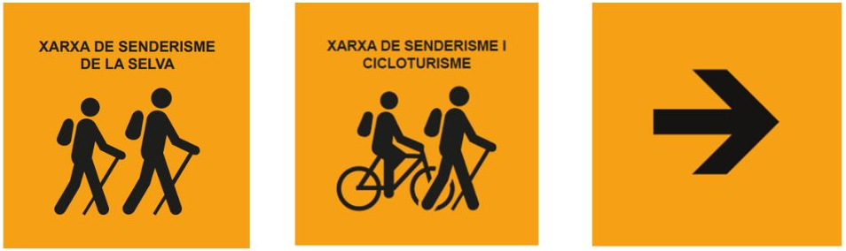
On the ground, you will notice that the Hiking Network is identified by small yellow signs that indicate that you are on the Network. On some occasions you may find that it is shared with the Cycling Network, which you will see reflected on the signs themselves. In any case, you will always see the icon of people walking and the word hiking.
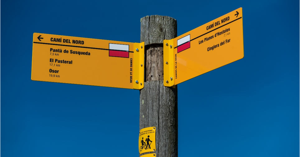
To choose your destination, at the main intersections of the Network you will find tracking banners that complement the information on the small signs and indicate the directions and distances to the nearest towns or points of interest.
Subscribe to the newsletter
Pla de Recuperació, Transformació i Resilência - Finançat per la Unió Europea - Next Generation UE
AODL en l\'ámbit del Patrimoni. Acció subvencionada pel Servei Públic d\'Ocupació de Catalunya en el marc dels Programes de Suport al Desenvolupament local.